If a picture paints a thousand words, then a map illustrates far more. The London Underground map has progressed from a simple geographically accurate portrayal of lines in 1908 to a constantly reinterpreted piece of iconic modernist art. Even in its most basic form, the evolution of the Tube map is a fascinating glimpse through London’s history, cataloguing the growth of the city over 100 years.
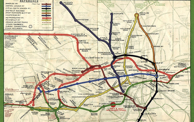
The Tube map was perpetually changing before the development of the iconic map in 1931. The first map designed in 1908 shows eight hand drawn lines concentrated around Central London, north of the River Thames. Interchanges weren’t clearly rendered, yet in an attempt to be geographically accurate, the above ground streets and sinuous rail lines were superimposed onto the map. As train lines extended, retaining a geographically correct map would have meant that the centre, being the most important area, would become increasingly dwarfed and illegible. For a bird with x-ray vision, it would have been an authentic depiction; for commuters, it proved to be utterly baffling.
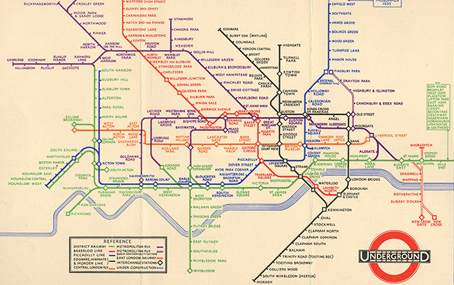
That would change in 1931, when Harry Beck, an engineering draftsman for the London Underground Signals Office began work on his prototype design for the map. Beck began by replacing the existing meandering curves with straight lines. He distorted its scale by spacing stations equidistantly and discarded the above ground street grid. The outcome was a visually clean design, inspired by a circuit board diagram and eschewing geographic precision for legibility and order. Graphic designer and Beck biographer Ken Garland declares that the map’s most innovative feature is its “convex lens” that disproportionately enlarges the area around central London. Beck redefined the very essence of the map and design history was made.
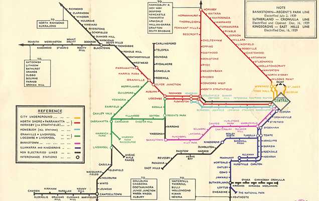
Underground authorities were not convinced by the radical idea. Public officials first greeted the map with apprehension, fearing it would be too radical a departure from the original, but eventually agreed to print it in pocket form in January 1933. It was published in poster format by March of that year, and before long, became the new standard across all of London. It also quickly influenced designs internationally, notably in Sydney, which we believe was the first to develop its own similar transit map in 1939.
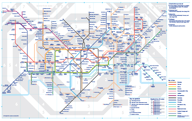
Today it’s the most recognisable and influential transit map in the world, continuing to be reinterpreted around the globe. The current Tube map shows a sprawling network of undergrounds, overgrounds and even cable cars. It may have foregone the rough charm of the original but the modern London Underground map is possibly the most practical and most used piece of art in the world.